Course Design for Blended Learning
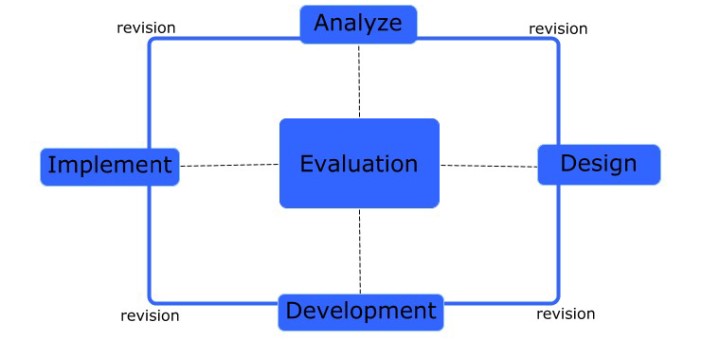
Description Blended teaching most often refers to courses where a portion of the seat-time is replaced with out-of-class or technology-facilitated learning. This process describes a strategy for a course design approach where technology utilization...